
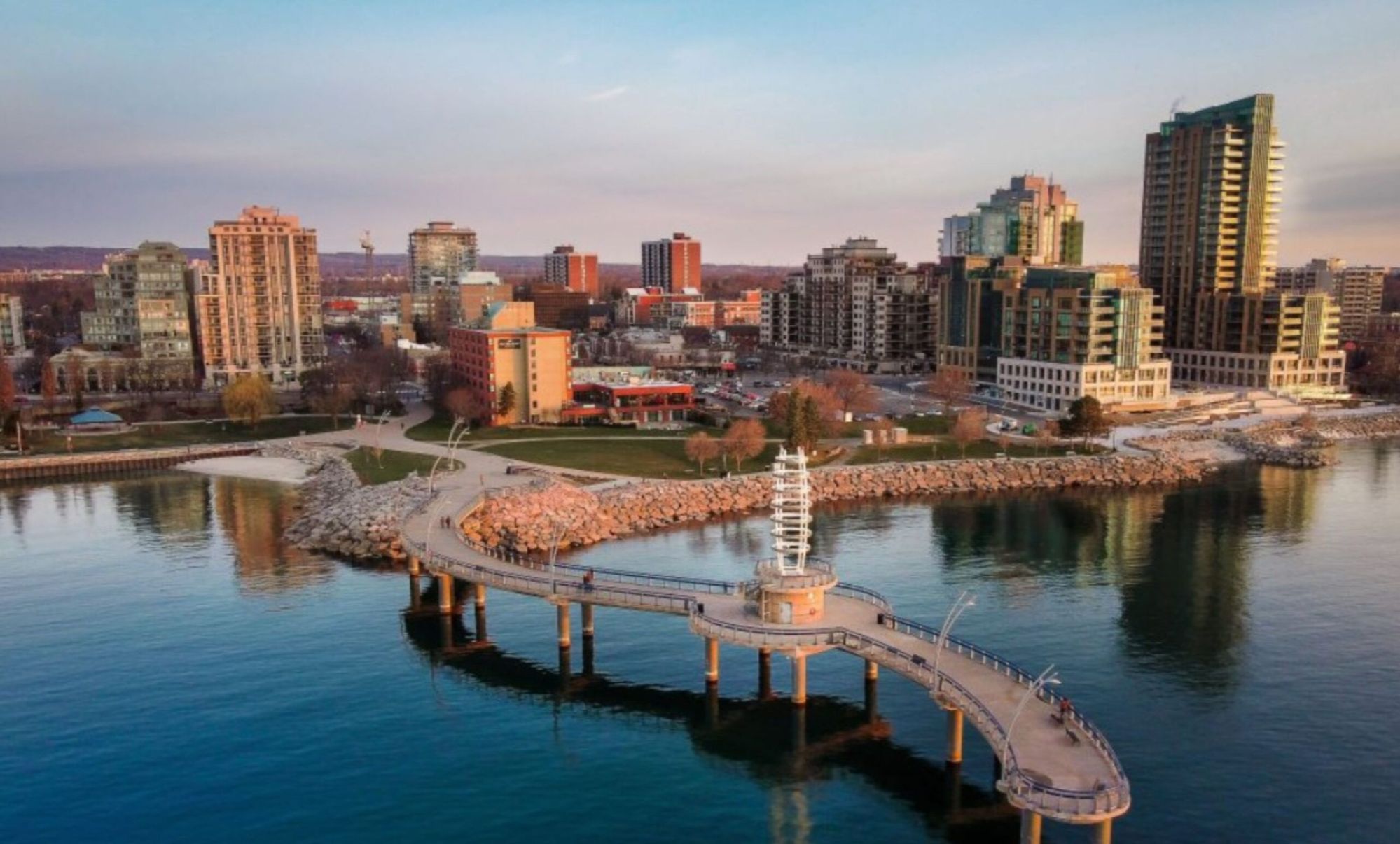
Burlington, Ontario
Lake on one side,
escarpment on the other.
A city of 187,000 wrapped around the head of Burlington Bay, with half its land area rural and protected above Dundas Street. Here's what living here actually looks like.
Half city, half Greenbelt,
and it shows.
Burlington sits at the western tip of Lake Ontario in Halton Region, between Oakville and Hamilton. The Niagara Escarpment runs across the north end — roughly half the city's land sits inside the Greenbelt and the Niagara Escarpment Biosphere Reserve.
Burlington — 186 km² on the bay
0
Residents
(2021 Census)
0 km²
Land Area
0
Became a City
0
Median Age
On the Bay
Spencer Smith Park, the Brant Street Pier and a continuous lakefront promenade running east to Burloak and Paletta Lakefront Park.
Three GO Stations
Aldershot, Burlington and Appleby on the Lakeshore West line, plus the QEW, 403 and 407. Union Station is roughly an hour.
The Escarpment
Mount Nemo, Rattlesnake Point and the Bruce Trail sit at the top of the city, with Lowville and Kilbride below them.
A Real Downtown
Brant Street's restaurants, the Burlington Performing Arts Centre and the Art Gallery of Burlington, all within blocks of the water.
Botanical Gardens
The Royal Botanical Gardens — about 1,100 hectares across Burlington and Hamilton — is headquartered here.
Twenty Neighbourhoods
From Aldershot's postwar cottages to Alton Village's new builds, with rural Burlington above the escarpment.
Population, area and median age from the 2021 Census of Population (Statistics Canada). Statistics Canada estimated roughly 197,000 residents in 2024. Burlington was incorporated as a village in the early 1870s and as a city in 1974.
What People Love
Why people move here
and then stay.
Ask ten Burlington residents why they chose it and you'll get roughly these six answers.
Twenty neighbourhoods,
and what each one is like.
Burlington runs from lakefront estates to working farms above the escarpment. Choose a neighbourhood to see the schools, parks, commute and housing mix that define it.
West · Bay to escarpment
Between the gardens and the bay
Burlington's western edge, running from the harbour up to the escarpment. Postwar cottages and bungalows on deep lots, with new mid-rise going up along Plains Road.
Schools
Glenview PS, Aldershot School
Parks & Green Space
Royal Botanical Gardens, LaSalle Park
Getting Around
Aldershot GO (also VIA); QEW and 403
Walkability
Somewhat walkable
Housing
Postwar cottages and bungalows plus new mid-rise condos
West-central · Plains Rd
The corridor that's redeveloping
Along Plains Road between Aldershot and downtown, where a wave of mid- and high-rise infill is replacing older commercial frontage.
Schools
Tom Thomson PS, Burlington Central HS
Parks & Green Space
Hidden Valley Park, RBG trails
Getting Around
Burlington GO nearby; QEW
Walkability
Somewhat walkable
Housing
Bungalows, split-levels, new high-rise infill
Southwest · Lakefront
The pier, the park, the main street
Burlington's core, built around Spencer Smith Park and the Brant Street Pier. Waterfront condos, a restaurant strip, and the arts centre all in walking distance.
Schools
Central PS, Burlington Central HS
Parks & Green Space
Spencer Smith Park, Brant Street Pier
Getting Around
Burlington Transit hub; QEW via Brant St
Walkability
Very walkable
Housing
Waterfront condos, mid- and high-rise, older bungalows
South-central · Maple Ave
Walk to the mall and the lake
Between downtown and Burlington Centre, with century homes beside split-levels and towers. One of the few pockets where you can walk to both shopping and water.
Schools
Tom Thomson PS, Burlington Central HS
Parks & Green Space
Central Park, lakefront access
Getting Around
Steps to Mapleview Centre; Fairview St
Walkability
Very walkable
Housing
Century homes, split-levels, townhouses, high-rise
South · Lakeshore estates
Burlington's most established address
South of New Street along the lake, laid out in the 1920s. English Cottage, Tudor, Georgian and Cape Cod homes on mature, generous lots.
Schools
John T. Tuck PS, Nelson HS
Parks & Green Space
Roseland Park, Lakeshore Rd trail
Getting Around
Short drive to Burlington GO; QEW
Walkability
Somewhat walkable
Housing
English Cottage, Tudor, Georgian and Cape Cod homes on mature lots
South-central
Central, and priced sensibly
Around Burlington Centre between Guelph Line and Walkers Line. Solid 1960s and 70s stock with townhomes and condos mixed through it.
Schools
Ryerson PS, Pineland PS, Nelson HS
Parks & Green Space
Sherwood Forest Park, Burlington Centre
Getting Around
New St and Guelph Line transit
Walkability
Somewhat walkable
Housing
1960s-70s bungalows, split-levels, townhomes, condos
South-central
Parks, pool and a skate park
South-central Burlington around Nelson Park, which carries a pool, skate park and BMX track. Raised ranches and splits, with newer townhouse infill.
Schools
Pauline Johnson PS, Nelson HS
Parks & Green Space
Nelson Park (pool, skate park, BMX)
Getting Around
New St corridor; QEW at Walkers Line
Walkability
Somewhat walkable
Housing
Raised ranches, back- and side-splits, newer townhouses
Southeast · Lakefront
Detached only, right to the water
Between Appleby Line and Walkers Line south of New Street. 1950s and 60s ranches alongside architect-designed lakefront estates — no townhomes, no condos.
Schools
John T. Tuck PS, Mohawk Gardens PS, Nelson HS
Parks & Green Space
Paletta Lakefront Park, Shoreacres Creek
Getting Around
Appleby GO nearby; QEW
Walkability
Car-dependent
Housing
1950s-60s ranches and architect-designed lakefront estates
Southeast
Walk to the GO
Around Appleby Line and New Street, with Appleby GO station inside it — unusual for Burlington, where most neighbourhoods drive to the train.
Schools
Pineland PS, Frontenac PS, Nelson HS
Parks & Green Space
Sheldon Creek corridor, Appleby Mall area
Getting Around
Appleby GO; QEW at Appleby Line
Walkability
Somewhat walkable
Housing
Bungalows, raised ranches, splits, 1990s detached pocket
Southeast · Lakefront
The Oakville border, on the water
Burlington's southeastern corner at Burloak. Large lots, quiet streets, and lakefront properties along the shore.
Schools
Mohawk Gardens PS, Pineland PS, Nelson HS
Parks & Green Space
Burloak Waterfront Park
Getting Around
Appleby GO; QEW at Burloak
Walkability
Car-dependent
Housing
Bungalows, splits and two-storeys on large lots; lakefront estates
Northwest · Escarpment edge
Golf course and the Bruce Trail
Built into the escarpment slope in the northwest, around the municipal golf course. Oversized lots and a lot of tree cover.
Schools
Maplehurst PS, Paul A. Fisher PS, M.M. Robinson HS
Parks & Green Space
Tyandaga Municipal Golf Course, Bruce Trail
Getting Around
Brant St and King Rd; QEW and 403
Walkability
Car-dependent
Housing
Large detached, bungalows and split-levels on oversized lots
Northwest
Pool, splash pad, and 1950s stock
North of the QEW along Brant Street, anchored by the Mountainside Recreation Centre. Colonial Revivals and ranch bungalows on established streets.
Schools
Clarksdale PS, Rolling Meadows PS, M.M. Robinson HS
Parks & Green Space
Mountainside Park and Recreation Centre
Getting Around
Brant St transit; QEW
Walkability
Somewhat walkable
Housing
1950s Colonial Revivals, split-levels, ranch bungalows
North-central
Trail access from the doorstep
North Burlington along Brant Street with direct Bruce Trail access. Detached two-storeys and bungalows, quiet and well-treed.
Schools
Brant Hills PS, Bruce T. Lindley PS, M.M. Robinson HS
Parks & Green Space
Brant Hills Park, Bruce Trail access
Getting Around
Brant St; Dundas St (Hwy 5)
Walkability
Car-dependent
Housing
Detached two-storeys, raised and ranch bungalows, side-splits
North-central
One era, one street pattern
A tightly planned 1980s community in north Burlington — uniform two-storeys on 50-foot lots, with a hydro-corridor path running through it.
Schools
C.H. Norton PS, Florence Meares PS, M.M. Robinson HS
Parks & Green Space
Hydro-corridor multi-use path, Headon Forest Park
Getting Around
Upper Middle Rd; Dundas St
Walkability
Car-dependent
Housing
Uniform 1980s two-storeys on 50x100 lots
Central · Guelph Line
Splits on big mature lots
Central Burlington along Guelph Line, built out with four- and five-level splits on lots that have had fifty years to grow in.
Schools
Dr. Charles Best PS, Sir Ernest MacMillan PS, M.M. Robinson HS
Parks & Green Space
Palmer Park, Central Park to the south
Getting Around
Guelph Line; QEW at Mainway
Walkability
Car-dependent
Housing
Four- and five-level side- and back-splits on mature lots
Northeast
Community centre and library
Northeast Burlington around the Tansley Woods Community Centre and library, with Sheldon Creek running through. Strong on bungalofts and low-rise condo.
Schools
Dr. Charles Best PS, M.M. Robinson HS
Parks & Green Space
Tansley Woods Community Centre and library, Sheldon Creek
Getting Around
Upper Middle Rd; Hwy 407
Walkability
Somewhat walkable
Housing
Bungalofts, condo townhomes, low-rise condo apartments
Northeast · Golf course
Executive homes around the course
Built around Millcroft Golf Club in the northeast. Executive two-storeys on wide frontages, and one of Burlington's most consistent family catchments.
Schools
Charles R. Beaudoin PS, Dr. Frank J. Hayden SS
Parks & Green Space
Millcroft Golf Club, Millcroft Park
Getting Around
Walkers Line; Hwy 407
Walkability
Car-dependent
Housing
Executive two-storey detached on 50-90 ft frontages
Far north
Burlington's newest full community
The city's northern edge below Dundas, built out through the 2000s and 2010s. Freehold detached, semis and live-work townhomes around new schools and rec facilities.
Schools
Alton Village PS, Dr. Frank J. Hayden SS
Parks & Green Space
Norton Community Park (skate park), Haber Recreation Centre
Getting Around
Appleby Line; Hwy 407 interchange
Walkability
Somewhat walkable
Housing
Freehold detached, semis, freehold and live-work townhomes
Northeast · Bronte Creek
Wrapped by a provincial park
Northeast Burlington against the Oakville border, with Bronte Creek Provincial Park wrapping the community. A lot of the housing backs onto ravine.
Schools
Orchard Park PS, Alexander's PS, John William Boich PS
Parks & Green Space
Bronte Creek Provincial Park
Getting Around
Appleby Line; QEW and 407
Walkability
Car-dependent
Housing
Two-storey detached (many ravine-backing) plus townhomes
North · Above the escarpment
Kilbride, Lowville, Mount Nemo
Above Highway 407 and inside the Greenbelt — working farms, century farmhouses and estate properties on well and septic, fifteen minutes from the QEW.
Schools
Kilbride PS, M.M. Robinson HS
Parks & Green Space
Mount Nemo Conservation Area, Lowville Park, Bruce Trail
Getting Around
Guelph Line and Appleby Line north of 407
Walkability
Car-dependent
Housing
Historic farmhouses, working farms, estate properties on wells and septic
Neighbourhood boundaries vary between sources, and school catchments change — always confirm the catchment for a specific address with the relevant school board.
Fun Facts
Nine things you probably
didn't know about Burlington.
Two rival grain ports, a comedy pipeline, and a bridge that used to charge you.
John Graves Simcoe named Burlington Bay in 1792 after Bridlington, England. The city took its name from the bay.
Mohawk leader Thayendanegea — Joseph Brant — received 3,450 acres at the head of the bay under the 1797 Brant Tract treaty. Much of early Burlington was built on land bought from his estate.
Brant's original house was demolished in 1923. A replica opened as the Joseph Brant Museum on May 22, 1942, and reopened after a major expansion in September 2019.
Wellington Square and Port Nelson both shipped grain to Montreal and Chicago before being merged into a single village in the early 1870s.
By 1846 the area ran 17 sawmills. By the late 1870s it had switched to fruit and vegetables — the Gallagher farm developed its own cantaloupe variety.
A 1902 promotional book and a 1913 Maclean's feature both sold the district under that name, on the strength of its orchards and market gardens.
Maclean's named Burlington the best community in Canada in 2019, placing it in the top quartile in six of ten categories.
The Burlington Bay Skyway opened October 30, 1958. Tolls came off in December 1973, and the second span opened in 1985.
Jim Carrey attended Aldershot High School; Ryan Gosling attended Lester B. Pearson, where Finger Eleven first played together. Sarah Harmer grew up on a farm in north Burlington.
Sources include the Canadian Encyclopedia, the Joseph Brant Museum, Museums of Burlington, Maclean's and Statistics Canada.


MARKET SNAPSHOT
(SEP 06, 2026 - OCT 06, 2026)
MARKET SNAPSHOT

Royal LePage
We are here 24/7 to assist you with your home buying and selling needs from start to finish.
- -Homes for Sale
- -Total Listings
- -Sales Price
- -Average Listing Price